
Grants
Marine Ecosystem Protection and Regeneration
Posidonia Protection in the Argolic Gulf
(2023) 15.576 € (BMF contribution 5.000€ ) awarded
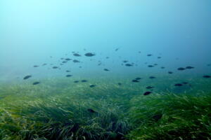
Seagrasses such as Posidonia oceanica are among the most important habitats of marine ecosystems. Seagrasses provide nursery and refuge grounds for a variety of coastal species. They are also some of the most productive ecosystems on our planet and highly effective carbon sinks especially due to their large extent; the more extensive and healthier the seagrass meadows, the higher their potential to remove and store carbon from the atmosphere. Moreover, they provide clean and transparent water.
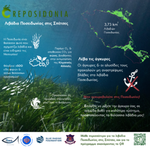
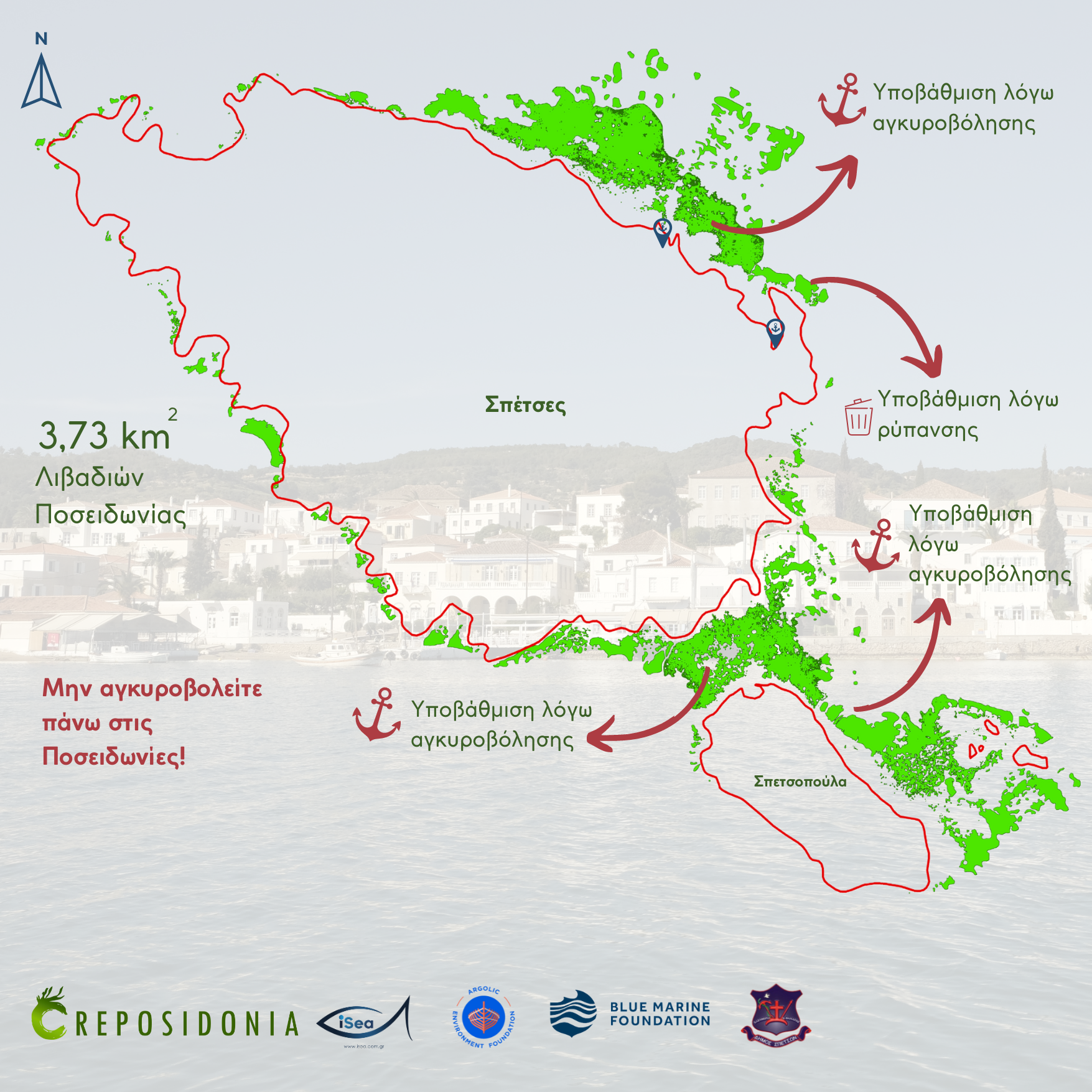
Despite the benefits and services that these ecosystems offer, they are some of the most threatened ecosystems globally. Therefore, in 2022 AEF participated in the project of REPOSIDONIA developed and implemented by iSea. Through this project AEF supported the mapping of the Posidonia in one of its key islands that of Spetses.
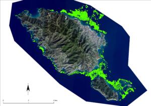
Mapping the Posidonia oceanica seagrasses of Spetses in 2022
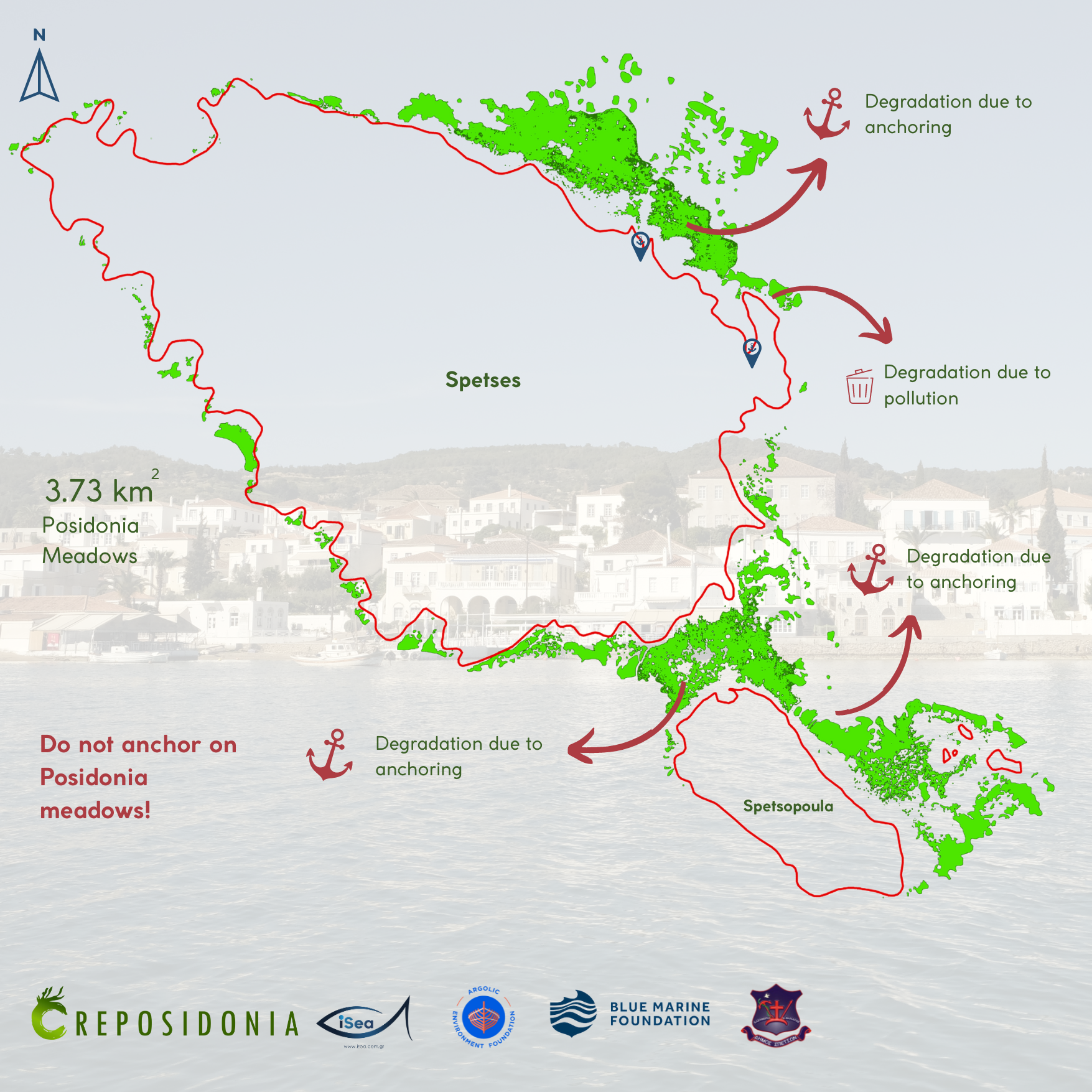
Through a Grant in 2022 iSea mapped the meadows of Posidonia oceanica seagrass around Spetses and the islet of Parapola (aka Velopoula). The high-resolution map was produced as a result of this project. Together with other data gathered by iSea divers during their field visits provide an unprecedented look at the extent and health of seagrass meadows in these waters. The report notes, these are fragmented in many areas due to anthropogenic factors with anchor tracks visible in many areas. Meanwhile, Velopoula was found to have over 10 times more extensive seagrass meadows than the estimated coverage in the relevant NATURA 2000 standard data form (SDF). The maps can be seen below.
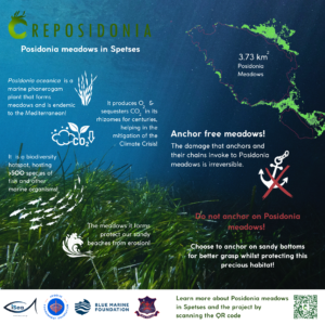
A leaflet for the yacht captains was also created in June 2023 and is being distributed through the Port manager of Spetses to yacht owners and captains when reaching the island. The leaflet contains information about the Posidonia and how to protect it.

Mapping the Posidonia oceanica seagrasses of Hydra in 2023
We are happy to announce that iSea has been awarded a new grant for the protection of the Posidonia from AEF and the Blue Marine Foundation. Through the mapping of the Posidonia and the informative posters we aim to better understand its coverage, distribution, and threats it faces, around the highly touristic island of the islands of the Argolic Gulf.
Hydra island like Spetses receives hundreds of visitors during the summer months and is among the most popular destinations for boat tourism. Moving around the island is mainly done with seataxis and boats. This high boat activity arises threats for the marine environment. In Greece, there are no official maps for seagrass meadows, except in N2K sites which date back to 00s and the approximate maps made by Ministry of Agriculture, to monitor large- scale fisheries. In the context of REPOSIDONIA, iSea aims to map the Posidonia in Hydra Island with ~3m resolution. This effort will set the road for future management actions, as it will help identify priority meadows in a region that are heavily disturbed.
Photo credits to iSea.